A common problem in the traceability of most agricultural goods is that the location of the field where the crop was produced remains unknown. In global procurement registering all participating smallholder fields is a costly effort and thus often not performed. However, new ESG reporting guidelines and deforestation laws require the exact geolocation for each crop procured. Crop mapping can solve this issue with a high degree of confidence.
Service Description
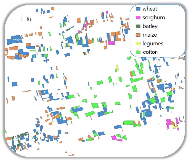
We perform crop mapping of field locations and sizes with high accuracy to fulfil ESG and traceability requirements. All crop maps will be validated to determine the accuracy of the model. Given good reference data an overall accuracy of 98% is well achievable. We can work with and without user provided reference data for model training.
Crop maps provide an accurate understanding of seeded crop areas. Thus, they allow to estimate volumes which will be procured at the end of the season. Even more important crop maps can make the process of registration of fields much more cost effective. In this case we can provide field boundaries with higher accuracies.