Near-realtime operational monitoring
In the frame of a cooperation with the Bavarian State Forest Service (Bayerische Staatsforsten) we developed and validated a forest water stress product to enable forest practitioners to early detect forest damage related to water stress. The product was found very useful by the users to identify relevant areas and act quickly.
2015 and 2018 were outstanding years with severe drought issues not only in agriculture but also in forestry in large parts of Germany. The year 2018 was one of the driest years of the century in Germany. Weather observations show that 2019 was as critical as 2018 in Germany.In Bavaria there are long term forest climate stations especially recording data since the 1960s.
Background
2015 and 2018 were outstanding years with severe drought issues not only in agriculture but also in forestry in large parts of Germany. The year 2018 was one of the driest years of the century in Germany. Weather observations show that 2019 was as critical as 2018 in Germany.
In Bavaria there are long term forest climate stations especially recording data since the 1960s.
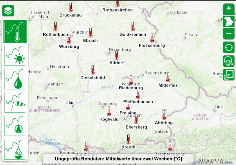
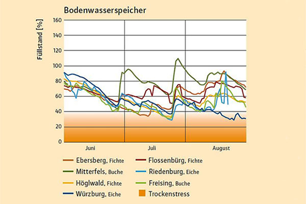
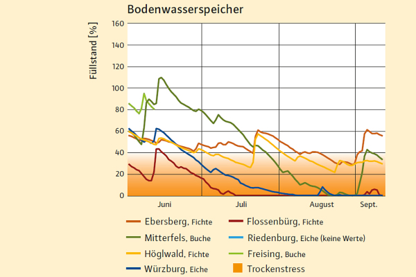
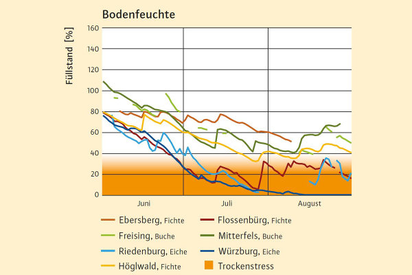
In the following diagrams one can compare a „regular“ year (2017) with the drought years 2018 and 2019. Most of the forest climate stations in northern Bavaria show water stress in 2018 and 2019.
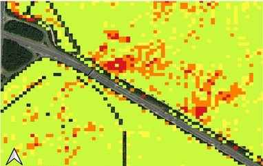
In July 2019 the Bavarian State Forest Service (Bayerische Staatsforsten) tasked us to create a forest drought map for ca. 35’000 ha of forest area in northern Bavaria from satellite data.
Product Development
We did a change detection of vegetation water status of 2019 and 2018 combining two vegetation indices derived from Sentinel-2 data.
We validated the computed drought map with field trips to areas with mostly broadleaf forest in the surroundings of Würzburg and to coniferous forest areas near Nuremberg.
On the spot we were supplied with special forest background knowledge from the local staff of the Bavarian State Forest Service. Furthermore the staff located us quickly to relevant areas.
The product was found very useful by the users to identify relevant areas and act quickly.
Continuous Monitoring
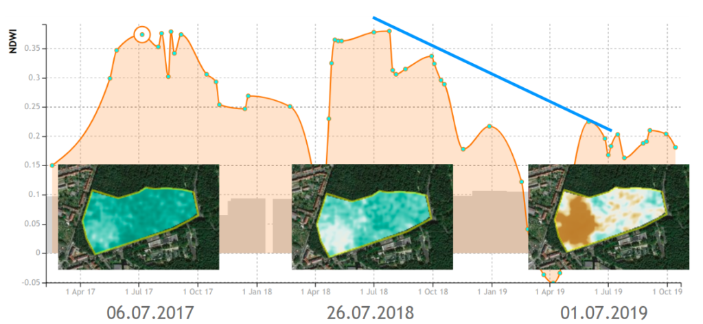
With the monitoring capabilities of our REST service ag|knowledge this service can be operationalized to deliver near-realtime insights visualized with our dashboard. In the area of Nuremberg there was a big sized pine damage in the western part of the registered parcel shown below. As one can see at the end of July 2018 there was already a decrease of the vegetation’s water content followed by a steady decline in autumn 2018 compared to 2017. In the summer of 2019 you see the low mean level of vegetation’s water content.
References
- LWF, forest climate stations: http://www.lwf.bayern.de/wks
- LWF, interactive map of forest climate stations: http://www.fovgis.bayern.de/wks