Use Cases: Sustainable Farming, Precision Farming, Extension services, Build your own Farming solution
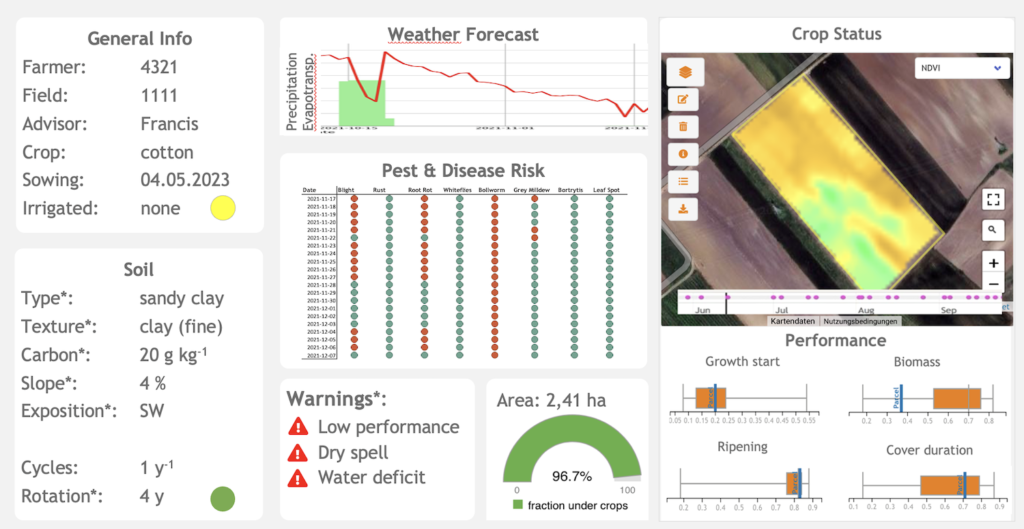
Our field-based Farming products support sustainable farming, precision farming, and extension services. This product suit allows you to build your own farming solution very easily by giving you easy access to satellite, weather and other geospatial data sets and powerful data analytics tools that give you insights in your farmers‘ crops and activities. Visualization components help you to quickly build your own application.

These are the Farming products:
- Satellite vegetation indexes
- Real cultivated area
- Alerts and warnings, e.g.
- Field Validation
- Water Deficit
- Pest and disease risk management
- 7-days agronomic weather forecast
- Sustainability KPIs
- Soil characteristics
- Management
- Crop rotation
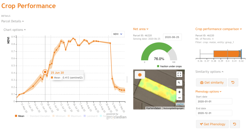
- Field comparisons
- Growth start
- Biomass
- Ripening
Sustainability KPI
We are checking remotely different good agricultural practices (GAP) at field level such as:
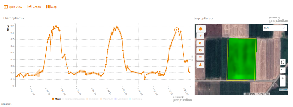
- Crop rotation
- Winter cover
- Crop cover ratio

Above a cotton field without crop rotation for three consecutive years.
Field comparisons
Based on our crop performance analysis tools we are enabling you to compare your fields regarding biomass and crop phenology, e.g. growth start or ripening. This allows you to focus on the fields that need attention and direct your agronomists more efficiently based on alerts and warnings.

Related services
The Sustainability Check is based on our crop monitoring API AgKnowledge. Please check also for related services such as:
Pricing
Please find pricing details here.
